A bay full of stories
The islands seen from Algies Bay, Snells Beach and Martins Bay are more than familiar shapes on the horizon. Their histories connect fishing grounds, Māori occupation, copper mining, coastal shipping, local families and the care of native wildlife. South of Kawau lie Motuketekete and the neighbouring Moturekareka, Motutara and Kohatutara group. Between Kawau and the mainland are the Mayne Islands: Takangariki and Takangaroa.
Middens, oven stones and a defended pā site recorded on Moturekareka are reminders that this history predates European settlement. Early transactions involving the southern islands included Ngāti Pāoa and Ngāti Rongo. These records are only part of the islands’ story, not a complete account of mana whenua relationships with the bay.
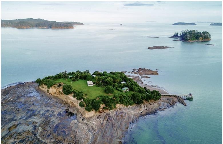
Takangariki — Rabbit Island
Rabbit Island, also once called Pine Island, is Takangariki. Its name is translated in local histories as ‘the short casting of the net’; neighbouring Takangaroa is ‘the long casting of the net’. The reefs between them are described as the net’s buoys. Together they are known as the Mayne Islands, recalling Edward Mayne, a magistrate appointed in 1848 with responsibility for keeping the peace on Kawau during the copper-mining era.
Allen Taylor bought Rabbit Island in the 1950s for £200 and owned it until 1974. An orchard grew among the pines that once covered much of it. In 1976, under new ownership, the pines were felled and taken by barge across Kawau Bay and up the Matakana River to the sawmill. Timber then returned to the island to build its long jetty across the shallow reef — a lovely connection between an island landmark and a local industry.
A Botanical Society account of a September 2022 visit, published in 2023, describes a beautiful private garden retreat with lawns, planted trees, small dwellings and naturally growing coastal vegetation.
Takangaroa — the bay’s former Goat Island
The Goat Island remembered in Kawau Bay is Takangaroa, the southerly Mayne Island. It should not be confused with Te Hāwere-a-Maki / Goat Island near Leigh and its marine reserve. A 1971 Gazette proclamation uses Takangaroa in place of Goat Island for the island’s wildlife refuge.
Judy Waters’ 2014 history links private ownership to Mr T. Clarkson, Kawau’s first radio operator. He came from Wellington in the mid-1920s when a telegraph office was established at Mansion House. Her account describes the island as managed for wildlife. The Gazette confirms a wildlife-refuge declaration.
Taungamaro — Beehive Island
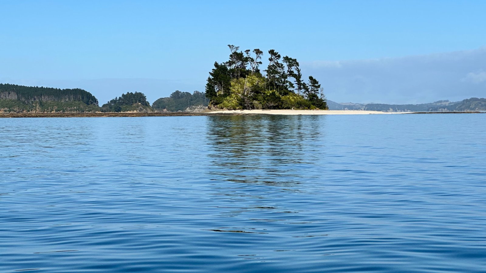
Known locally as ‘the Beehive’, Taungamaro lies about a kilometre off the south-western tip of Kawau Island. Its distinctive steep central outcrop, edged by beautiful white sand, gives this little island an almost Pacific-atoll appearance — although it is not a coral atoll. It is a memorable part of the bay’s island landscape and a favourite kind of destination for a day on the water and a picnic lunch.
In a 2018 Wilderness Magazine account, sea kayaker Shaun Barnett describes a skirt of bright white sand surrounding the island at high tide. As the tide falls, a much wider reef emerges, revealing layered rock, oysters and periwinkles. That changing shoreline is part of the Beehive’s charm: the same island can look quite different over the course of a visit.
Local recollections describe approaching the beach carefully from the north, with reefs extending on either side. This is not a navigation guide: check current marine charts, tides, weather and sea conditions before visiting, and do not assume the approach is clear or safe for your boat. Landing can be dangerous in rough seas. On a suitable calm day, it is a lovely place to pause for lunch, enjoy the white sand.
Motuketekete — copper, the Scandretts and the Vivians
Motuketekete lies across the South Channel from Kawau and is separated from Moturekareka by the Blanche Channel. Ewen Cameron’s 2015 botanical history translates its name as ‘Food Basket Island’, reflecting the surrounding kaimoana.
Frederick Whittaker and Theophilus Heale acquired Motuketekete from the Crown in 1850. Rivalry with the existing Kawau copper operation meant their workers lived on this island and travelled across to work. A smelting furnace operated here; remnants of firebrick, slag and other industrial features were still recorded in the 2015 study. This quiet island once belonged to a busy industrial landscape.
The Scandrett family — familiar locally through Scandrett Regional Park — owned Motuketekete from 1880 to 1907. They sold it to Thomas Phillip Vivian for £190. Cameron’s 2015 account identifies John Vivian as owner and records continuous Vivian family ownership since 1907, noting that this family is not related to the name Vivian Bay on Kawau. The island’s later story includes farming, pine planting and conservation work. Auckland Council and DOC-supported rodent work in 2014–15 linked it with restoration on the neighbouring islands.
Moturekareka — island residents and the Rewa
Moturekareka’s sheltered bay is best known for the remains of the Rewa, the former Alice A. Leigh. Charlie Hansen, a retired sheep farmer, lived here from the late 1920s and had the ship brought to the island in 1930 as a breakwater. Accounts also describe ambitions for accommodation or a floating entertainment venue, but the vessel’s heavy list made those plans impractical.
Another well-known resident, Snow Harris, lived on the island from 1962 until his death in 1978. The 1997 history describes his monthly rowing trips to Kawau for supplies. DOC purchased Moturekareka in October 1993; it was gazetted as a scenic reserve in May 1996.
Motutara — an island that helped build local roads
A shingle connection links Motutara with Moturekareka at lower tides, disappearing as the water rises. Much of Motutara’s western end was quarried after land was taken by the Crown in 1929. Road metal left the island by sea; the Jane Gifford carried material from the Public Works Department quarry for roads in the Mahurangi district. The island therefore has a direct connection to the infrastructure of the communities looking out towards it.
The former quarry reserve joined the Hauraki Gulf Maritime Park in 1968, with the remaining land brought into public ownership later. Motutara was reclassified as a scenic reserve in 1980. Its altered headland is a reminder of a time when coastal scows, rather than trucks, moved heavy materials around the gulf.
Kohatutara — the Rocky Islets
Kohatutara is the cluster of rocky stacks and vegetated islets beside Motutara. Low tide exposes connecting rock shelves, while higher water separates the group. It entered the Hauraki Gulf Maritime Park in 1977 and became a scenic reserve in 1980. Research on this group recorded nesting grey-faced petrels, visiting coastal birds and skinks.
The wider bay — Kawau and Motuora
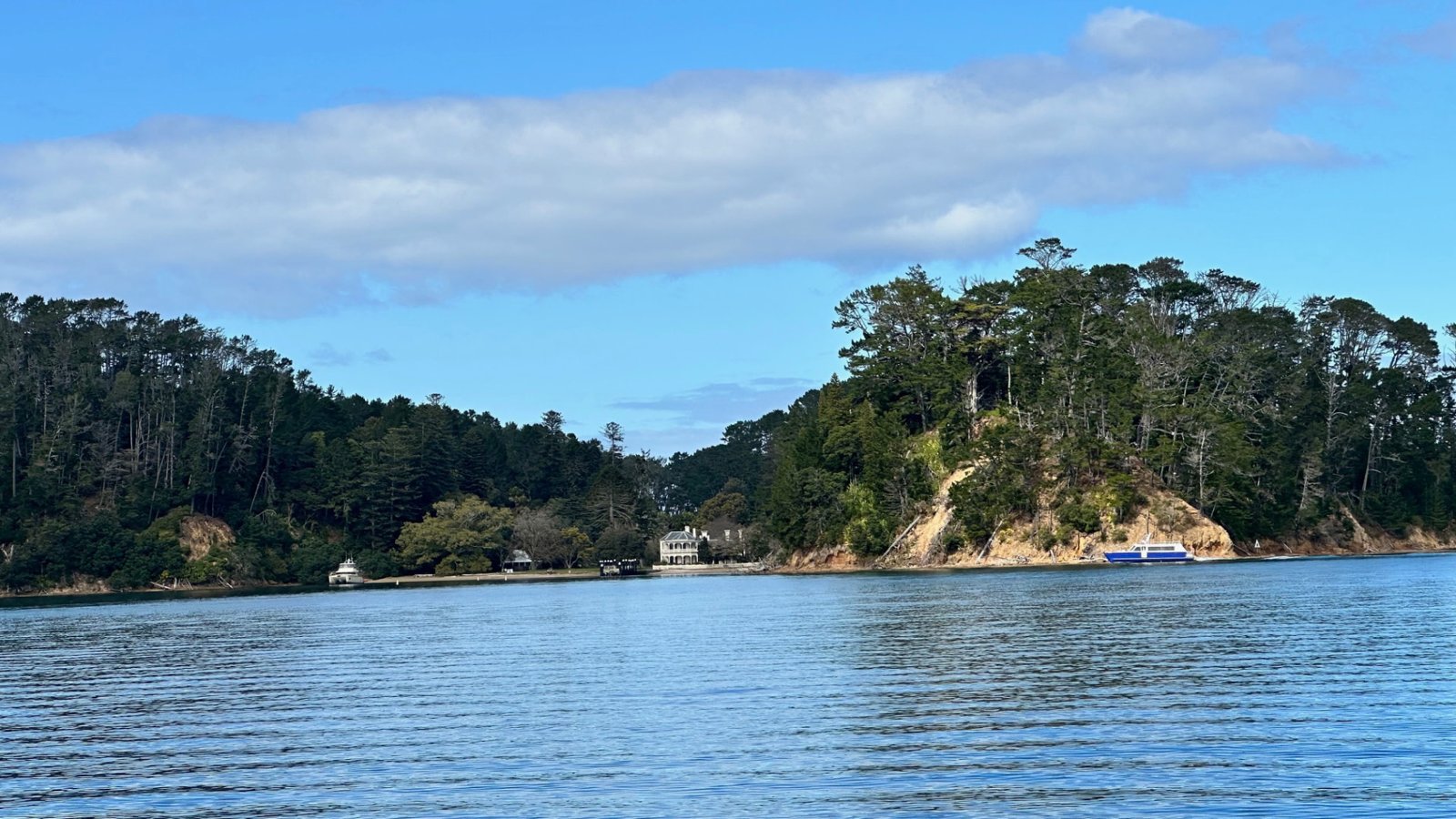
Kawau gives the bay its sheltered character and its best-known island landmark, Mansion House. The house began as the copper-mine superintendent’s residence. Sir George Grey bought Kawau in 1862, enlarged the house and introduced an extraordinary collection of plants and animals. DOC records Mansion House as publicly owned since 1967. Today the historic reserve sits within an island that also has private homes and properties — Kawau is not entirely a public reserve.
Further south, Motuora’s present-day recreation reserve and restoration landscape bring together evidence of Māori occupation, early European settlement and native wildlife. DOC’s walking routes pass through former paddocks being replanted with native species. The island’s conservation and recreation role offers another chapter in the bay’s changing relationship with its offshore neighbours.
More local stories
Sources & further reading
A short local-interest account compiled from the published histories below. Ownership references are dated to their sources; Māori names and translations follow those publications.
- Shaun Barnett — Beehives: Beehive / Taungamaro Island (Wilderness Magazine, 2018)
- Judy Waters — History: Island life (Local Matters, 2014)
- Maureen Young — Rabbit Island / Takangariki (Auckland Botanical Society, 2023)
- Ewen K. Cameron — Motuketekete and the Moturekareka group (2015)
- Tennyson, Cameron & Taylor — Fauna, flora and history of Moturekareka, Motutara and Kohatutara (1997)
- New Zealand Gazette — Takangaroa Island Wildlife Refuge (22 July 1971)
- DOC — History of Mansion House, Kawau Island
- DOC — Motuora Island walks